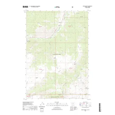
2020 Map of Mount Maurice
USGS Topo · Published 2020About this map
Richel Lodge serves as a lone landmark of settlement in this high-elevation landscape where the border of Montana and Wyoming meets. The topography is dominated by the sprawling Line Creek Plateau and the deeply incised Line Creek Basin, illustrating the stark transition from mountain peaks to drainage draws. In the northern reaches, Wapiti Mtn and Maurice Mt overlook a network of seasonal and permanent watercourses including Rock Cr and Silver Run Cr.
Find a feature on this map
45 named features on this map. Tap any name to fly to it.
Don’t see what you’re looking for? This feature index may not catch every label — zoom into the map to look around manually.
Map Details
Editions of this 2020 Mount Maurice Map
This is the sole edition of this map. No revisions or reprints were ever made.
Other maps of this area

1944 · Red Lodge
USGS Topo · 1:62,500

1950 · Clark
USGS Topo · 1:62,500

1950 · Deep Lake
USGS Topo · 1:62,500

1954 · Billings
USGS Topo · 1:250,000

1955 · Cody
USGS Topo · 1:250,000

1956 · Mount Maurice
USGS Topo · 1:62,500

1957 · Billings
USGS Topo · 1:250,000

1958 · Billings
USGS Topo · 1:250,000

1958 · Cody
USGS Topo · 1:250,000

1962 · Cody
USGS Topo · 1:250,000