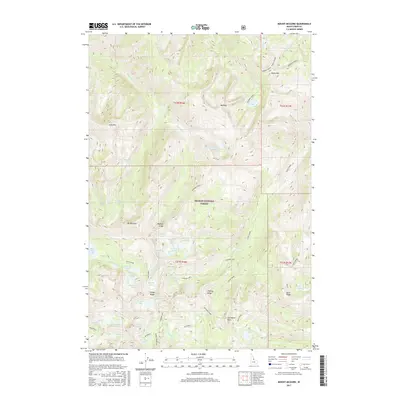
2017 Map of Mount McGuire
USGS Topo · Published 2017About this map
Mt McGuire stands as a central topographic anchor within the Salmon National Forest, presiding over a landscape defined by glacial activity and high-elevation drainage systems. The northern reaches of the Bighorn Crags dominate this territory, characterized by sharp alpine crests like Fishfin Ridge and Gant Ridge. Water features are abundant across this 2017 survey, where high-altitude basins hold numerous named bodies such as Ship Island Lake, Sheepeater Lake, and the clustered Roaring Creek Lakes. The drainage network, including Roaring Cr and Waterfall Cr, illustrates the complex hydrology of the Lemhi County backcountry. Landmarks like Cathedral Rock and the Beehive provide distinct navigational points for those tracing the wilderness topography, while the inclusion of Shoban Lake and Terrace Lakes highlights the density of the lake basins found throughout this high-mountain region.
Find a feature on this map
59 named features on this map. Tap any name to fly to it.
Don’t see what you’re looking for? This feature index may not catch every label — zoom into the map to look around manually.
Map Details
Editions of this 2017 Mount McGuire Map
This is the sole edition of this map. No revisions or reprints were ever made.
Other maps of this area

1950 · Blackbird Mtn
USGS Topo · 1:62,500

1951 · Blackbird Mtn
USGS Topo · 1:62,500

1956 · Elk City
USGS Topo · 1:250,000

1960 · Elk City
USGS Topo · 1:250,000

1960 · Shoup
USGS Topo · 1:62,500

1962 · Hoodoo Meadows
USGS Topo · 1:24,000

1962 · Long Tom Mtn
USGS Topo · 1:24,000

1962 · Puddin Mtn
USGS Topo · 1:24,000

1962 · Aggipah Mtn
USGS Topo · 1:24,000

1962 · Mt Mc Guire
USGS Topo · 1:24,000