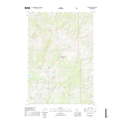
2020 Map of Mount McGuire
USGS Topo · Published 2020About this map
Mt McGuire and the dramatic topography of the Bighorn Crags dominate this high-elevation portion of the Salmon National Forest in Lemhi County. The landscape is defined by its complex network of alpine basins and granite ridges, containing dozens of named lakes including Ship Island Lake, Gooseneck Lake, and Roaring Cr Lakes. The survey illustrates the glacial carving of the region, where features like Fishfin Ridge and Fishing Ridge separate drainage basins. Notable landmarks like Cathedral Rock and Dome Mtn serve as primary navigational points in this wilderness area. The map also records numerous seasonal waterways such as Garden Cr and Waterfall Cr, alongside unique features like Ship Island and the humorously named Puddin Mountain.
Find a feature on this map
47 named features on this map. Tap any name to fly to it.
Don’t see what you’re looking for? This feature index may not catch every label — zoom into the map to look around manually.
Map Details
Editions of this 2020 Mount McGuire Map
This is the sole edition of this map. No revisions or reprints were ever made.
Other maps of this area

1950 · Blackbird Mtn
USGS Topo · 1:62,500

1951 · Blackbird Mtn
USGS Topo · 1:62,500

1956 · Elk City
USGS Topo · 1:250,000

1960 · Elk City
USGS Topo · 1:250,000

1960 · Shoup
USGS Topo · 1:62,500

1962 · Hoodoo Meadows
USGS Topo · 1:24,000

1962 · Long Tom Mtn
USGS Topo · 1:24,000

1962 · Puddin Mtn
USGS Topo · 1:24,000

1962 · Aggipah Mtn
USGS Topo · 1:24,000

1962 · Mt Mc Guire
USGS Topo · 1:24,000