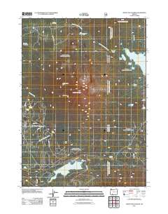
2011 Map of Mount McLoughlin
USGS Topo · Published 2011About this map
Mount McLoughlin dominates this High Cascades landscape, with its prominent northern and southern peaks, North Squaw Tip and South Squaw Tip, rising above a complex network of volcanic lakes and seasonal camps. The high-altitude terrain is defined by water resources and recreational infrastructure, notably the Fish Lake reservoir and the nearby Fish Lake Resort. Further north, a series of smaller water bodies including Fourmile Lake, Squaw Lake, and the curiously named Lake Malice and Lake Janice are scattered across the plateau.
Find a feature on this map
39 named features on this map. Tap any name to fly to it.
Don’t see what you’re looking for? This feature index may not catch every label — zoom into the map to look around manually.
Map Details
Editions of this 2011 Mount McLoughlin Map
This is the sole edition of this map. No revisions or reprints were ever made.
Other maps of this area

1891 · Ashland
USGS Topo · 1:250,000

1893 · Ashland
USGS Topo · 1:250,000

1897 · Ashland
USGS Topo · 1:250,000

1955 · Lake O' Woods
USGS Topo · 1:62,500

1955 · Rustler Peak
USGS Topo · 1:62,500

1955 · Mt. Mc Loughlin
USGS Topo · 1:62,500

1955 · Pelican Butte
USGS Topo · 1:62,500

1955 · Medford
USGS Topo · 1:250,000

1957 · Medford
USGS Topo · 1:250,000

1958 · Medford
USGS Topo · 1:250,000