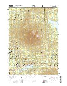
2014 Map of Mount McLoughlin
USGS Topo · Published 2014About this map
Mount McLoughlin dominates this 2014 survey, marking the high point of the Southern Cascades where the boundaries of Rogue River National Forest and Winema National Forest meet. The map documents a high-altitude landscape defined by volcanic peaks and alpine hydrology, including N Squaw Tip and S Squaw Tip. Water management and recreation are central themes here, evidenced by the presence of Fish Lake and Fourmile Lake, alongside the engineering of the Cascade Canal.
Find a feature on this map
42 named features on this map. Tap any name to fly to it.
Don’t see what you’re looking for? This feature index may not catch every label — zoom into the map to look around manually.
Map Details
Editions of this 2014 Mount McLoughlin Map
This is the sole edition of this map. No revisions or reprints were ever made.
Other maps of this area

1891 · Ashland
USGS Topo · 1:250,000

1893 · Ashland
USGS Topo · 1:250,000

1897 · Ashland
USGS Topo · 1:250,000

1955 · Lake O' Woods
USGS Topo · 1:62,500

1955 · Rustler Peak
USGS Topo · 1:62,500

1955 · Mt. Mc Loughlin
USGS Topo · 1:62,500

1955 · Pelican Butte
USGS Topo · 1:62,500

1955 · Medford
USGS Topo · 1:250,000

1957 · Medford
USGS Topo · 1:250,000

1958 · Medford
USGS Topo · 1:250,000