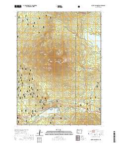
2020 Map of Mount McLoughlin
USGS Topo · Published 2020About this map
Mt McLoughlin dominates the volcanic landscape of southern Oregon, standing at the center of a topography defined by alpine lakes and high-altitude springs. The boundary between Jackson and Klamath counties runs through this high country, which is managed within the Rogue River National Forest and Winema National Forest. Water is a primary feature of the region, from the expansive Fish Lake and Fourmile Lake to smaller bodies such as Summit Lake, Mirror Pond, and Squaw Lake.
Find a feature on this map
62 named features on this map. Tap any name to fly to it.
Don’t see what you’re looking for? This feature index may not catch every label — zoom into the map to look around manually.
Map Details
Editions of this 2020 Mount McLoughlin Map
This is the sole edition of this map. No revisions or reprints were ever made.
Other maps of this area

1891 · Ashland
USGS Topo · 1:250,000

1893 · Ashland
USGS Topo · 1:250,000

1897 · Ashland
USGS Topo · 1:250,000

1955 · Lake O' Woods
USGS Topo · 1:62,500

1955 · Rustler Peak
USGS Topo · 1:62,500

1955 · Mt. Mc Loughlin
USGS Topo · 1:62,500

1955 · Pelican Butte
USGS Topo · 1:62,500

1955 · Medford
USGS Topo · 1:250,000

1957 · Medford
USGS Topo · 1:250,000

1958 · Medford
USGS Topo · 1:250,000