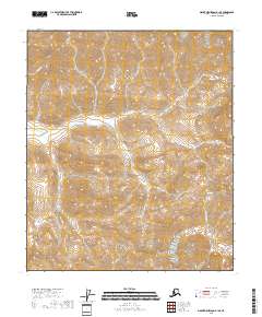
2018 Map of Mount Michelson A-1 SE
USGS Topo · Published 2018About this map
Hulahula River flows through this portion of the North Slope, tracing a path through the remote Arctic landscape of the Brooks Range foothills. The hydrology is the primary focus of this modern survey, which records the braided drainage patterns of the Sheenjek River and the headwaters of E Fork Itkillik Cr. These water systems define the geography of the North Slope Borough, where the vast township and range boundaries of t4s r33e and t5s r34e represent the formal surveying of one of the most secluded regions in North America. The map provides a precise record of the elevation and natural contours that dictate the seasonal flow of these Arctic river systems.
Find a feature on this map
8 named features on this map. Tap any name to fly to it.
Don’t see what you’re looking for? This feature index may not catch every label — zoom into the map to look around manually.
Map Details
Editions of this 2018 Mount Michelson A-1 SE Map
This is the sole edition of this map. No revisions or reprints were ever made.
Other maps of this area

1951 · Demarcation Point
USGS Topo · 1:250,000

1951 · Arctic
USGS Topo · 1:250,000

1951 · Table Mountain
USGS Topo · 1:250,000

1951 · Mt. Michelson
USGS Topo · 1:250,000

1955 · Demarcation Point
USGS Topo · 1:250,000

1956 · Table Mountain
USGS Topo · 1:250,000

1956 · Arctic
USGS Topo · 1:250,000

1956 · Mt. Michelson
USGS Topo · 1:250,000

1964 · Table Mountain
USGS Topo · 1:250,000

1964 · Demarcation Point
USGS Topo · 1:250,000