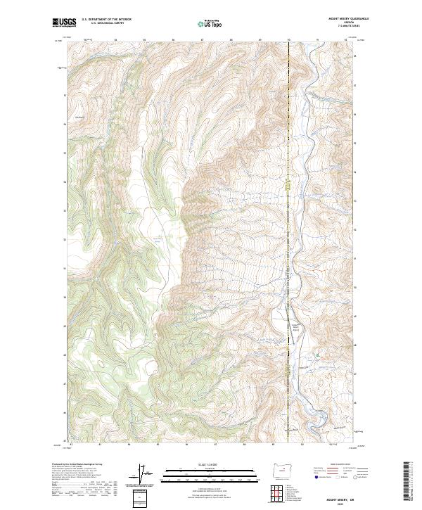
2023 Map of Mount Misery
USGS Topo · Published 2023About this map
The John Day Fossil Beds National Monument occupies the eastern edge of this landscape, where the John Day River carves a deep path through the canyonlands of Wheeler and Grant counties. This territory is defined by its complex drainage network, where seasonal and permanent streams like Hide and Seek Creek, McGinnis Creek, and Frank Creek feed into the river system. The presence of the Longview Ranch Airport near Hwy 19 indicates the importance of private aviation and ranching infrastructure in this part of Oregon.
Find a feature on this map
37 named features on this map. Tap any name to fly to it.
Don’t see what you’re looking for? This feature index may not catch every label — zoom into the map to look around manually.
Map Details
Editions of this 2023 Mount Misery Map
This is the sole edition of this map. No revisions or reprints were ever made.
Other maps of this area

1953 · Richmond
USGS Topo · 1:62,500

1953 · Kimberly
USGS Topo · 1:62,500

1953 · Picture
USGS Topo · 1:62,500

1953 · Spray
USGS Topo · 1:62,500

1955 · Canyon City
USGS Topo · 1:250,000

1959 · Canyon City
USGS Topo · 1:250,000

1980 · Monument
USGS Topo · 1:100,000
1990 · Miller Flat
USGS Topo · 1:24,000
1990 · Tubb Spring
USGS Topo · 1:24,000
1990 · Picture Gorge West
USGS Topo · 1:24,000