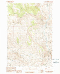
1990 Map of Picture Gorge West
USGS Topo · Published 1990About this map
The John Day River carves a dramatic path through the landscape of Wheeler and Grant counties, where the geological history of the John Day Fossil Beds National Monument is on full display. This 1990 provisional survey documents a region defined by its sharp verticality, from the towering landmark of Sheep Rock to the narrow passage of Picture Gorge in the southeast. Ranching history is deeply etched into the terrain, with family-named operations like the Cant Ranch and Humphrey Ranch positioned along the river's fertile edge.
Find a feature on this map
30 named features on this map. Tap any name to fly to it.
Don’t see what you’re looking for? This feature index may not catch every label — zoom into the map to look around manually.
Map Details
Editions of this 1990 Picture Gorge West Map
This is the sole edition of this map. No revisions or reprints were ever made.
Other maps of this area

1932 · Dayville
USGS Topo · 1:125,000

1936 · Dayville
USGS Topo · 1:125,000

1953 · Richmond
USGS Topo · 1:62,500

1953 · Picture
USGS Topo · 1:62,500

1955 · Canyon City
USGS Topo · 1:250,000

1959 · Canyon City
USGS Topo · 1:250,000

1966 · Antone
USGS Topo · 1:24,000

1972 · Day Basin
USGS Topo · 1:24,000
1972 · Dayville
USGS Topo · 1:24,000

1980 · Monument
USGS Topo · 1:100,000