
1972 Map of Day Basin
USGS Topo · Published 1976About this map
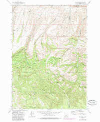
The Ochogo National Forest dominates the southern reaches of this landscape, where the high ridges of A and M Ridge and Cougar Ridge overlook deep drainage basins. Published in 1976 from 1972 field checks, the survey shows a territory defined by its water sources and livestock history, including the curiously named Breathing Spring and Home Sweet Home Spring. To the north, the terrain transitions toward the John Day Fossil Beds National Monument, reflecting the transition from timbered forest to the geologic exposures of the Day Basin. Transportation is largely restricted to a network of jeep and pack trails, connecting isolated locations like the Nelson Place and China Camp. The map also captures local extraction and grazing landmarks, from several Borrow Pits to the sprawling McClanahan Meadow near Black Canyon Creek.
Find a feature on this map
41 named features on this map. Tap any name to fly to it.
Don’t see what you’re looking for? This feature index may not catch every label — zoom into the map to look around manually.
Map Details
Editions of this 1972 Day Basin Map
2 editions found
Other maps of this area

1932 · Dayville
USGS Topo · 1:125,000

1936 · Dayville
USGS Topo · 1:125,000

1953 · Richmond
USGS Topo · 1:62,500

1953 · Picture
USGS Topo · 1:62,500

1955 · Canyon City
USGS Topo · 1:250,000

1959 · Canyon City
USGS Topo · 1:250,000

1966 · Antone
USGS Topo · 1:24,000

1966 · Six Corners
USGS Topo · 1:24,000

1972 · Wolf Mountain
USGS Topo · 1:24,000
1972 · Aldrich Gulch
USGS Topo · 1:24,000