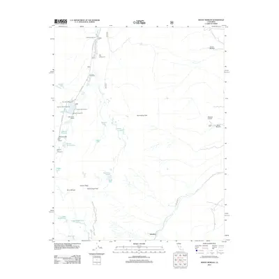
2012 Map of Mount Morgan
USGS Topo · Published 2012About this map
Mount Morgan and the high-altitude terrain of the Sierra Nevada dominate this 2012 survey, which documents a landscape shaped by both geological forces and recreation. The settlement of Scheelite sits at the base of the mountains, while the upper reaches are defined by a dense network of alpine lakes, including Upper Morgan Lake, Lower Morgan Lake, and the cluster of Eastern Brook Lakes. The presence of several established campsites, such as Rock Creek Lake Campground and Mosquito Flat Campground, indicates the area's significance for backcountry access.
Find a feature on this map
37 named features on this map. Tap any name to fly to it.
Don’t see what you’re looking for? This feature index may not catch every label — zoom into the map to look around manually.
Map Details
Editions of this 2012 Mount Morgan Map
This is the sole edition of this map. No revisions or reprints were ever made.
Other maps of this area

1912 · Mt. Goddard
USGS Topo · 1:125,000

1914 · Mt. Morrison
USGS Topo · 1:125,000

1947 · Mariposa
USGS Topo · 1:250,000

1948 · Mariposa
USGS Topo · 1:250,000

1949 · Mt. Tom
USGS Topo · 1:62,500

1951 · Mt. Tom
USGS Topo · 1:62,500

1953 · Mt. Morrison
USGS Topo · 1:62,500

1953 · Casa Diablo Mtn
USGS Topo · 1:62,500

1953 · Mt Abbot
USGS Topo · 1:62,500
1954 · Mt. Tom
USGS Topo · 1:62,500