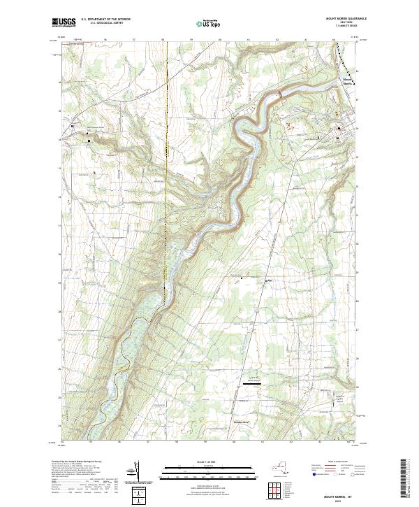
2023 Map of Mount Morris
USGS Topo · Published 2023About this map
The Genesee River carves a deep path through the landscape of Livingston and Wyoming Counties, defining the northern reaches of Letchworth State Park. This terrain is characterized by the winding waterway and its tributaries, including Silver Lake Outlet and Allens Creek, which meet near the village of Mount Morris. The local topography is notable for the Tuscarora Plateau to the southeast and the various ravines formed by smaller streams like Buck Run Creek and Eastover Brook.
Find a feature on this map
87 named features on this map. Tap any name to fly to it.
Don’t see what you’re looking for? This feature index may not catch every label — zoom into the map to look around manually.
Map Details
Editions of this 2023 Mount Morris Map
This is the sole edition of this map. No revisions or reprints were ever made.
Other maps of this area

1904 · Batavia
USGS Topo · 1:62,500

1904 · Caledonia
USGS Topo · 1:62,500

1905 · Portage
USGS Topo · 1:62,500

1905 · Nunda
USGS Topo · 1:62,500

1943 · Mount Morris
USGS Topo · 1:24,000

1943 · Sonyea
USGS Topo · 1:24,000

1943 · Nunda
USGS Topo · 1:24,000

1943 · Ossian
USGS Topo · 1:24,000

1943 · Castile
USGS Topo · 1:24,000

1943 · Portageville
USGS Topo · 1:24,000