
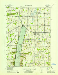
1943 Map of Sonyea
USGS Topo · Published 1960About this map
Craig Colony and the nearby settlement of Sonyea occupy a central position in this 1940s landscape, illustrating the complex social and institutional history of Livingston County. The terrain is defined by the winding course of Canaseraga Creek and the historical footprint of the Canaseraga Canal, which parallel a dense concentration of rail infrastructure. The Delaware Lackawanna and Western and the Dansville and Mount Morris railroads intersect the valley, supporting small rural hubs like Kysorville and Groveland.
Find a feature on this map
30 named features on this map. Tap any name to fly to it.
Don’t see what you’re looking for? This feature index may not catch every label — zoom into the map to look around manually.
Map Details
Editions of this 1943 Sonyea Map
This is the sole edition of this map. No revisions or reprints were ever made.
Other maps of this area

1901 · Honeoye
USGS Topo · 1:62,500

1902 · Wayland
USGS Topo · 1:62,500

1904 · Wayland
USGS Topo · 1:62,500

1904 · Caledonia
USGS Topo · 1:62,500

1904 · Honeoye
USGS Topo · 1:62,500

1905 · Nunda
USGS Topo · 1:62,500

1942 · Dansville
USGS Topo · 1:31,680

1942 · Conesus
USGS Topo · 1:31,680
1942 · Livonia
USGS Topo · 1:31,680

1943 · Mount Morris
USGS Topo · 1:24,000