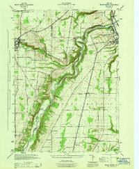
1944 Map of Mount Morris
USGS Topo · Published 1944About this map
The Genesee River snakes through a deeply incised valley in this mid-1940s survey, marking a sharp contrast between the dramatic river bluffs and the surrounding agricultural plateaus of Livingston and Wyoming Counties. The village of Mount Morris sits as a regional hub at the northeastern corner, where the river meets the Delaware Lackawanna & Western and Pennsylvania railroads. This rail infrastructure was critical for moving local produce and timber out of the Genesee Valley during the war years.
Find a feature on this map
38 named features on this map. Tap any name to fly to it.
Don’t see what you’re looking for? This feature index may not catch every label — zoom into the map to look around manually.
Map Details
Editions of this 1944 Mount Morris Map
This is the sole edition of this map. No revisions or reprints were ever made.
Other maps of this area

1904 · Batavia
USGS Topo · 1:62,500

1904 · Caledonia
USGS Topo · 1:62,500

1905 · Portage
USGS Topo · 1:62,500

1905 · Nunda
USGS Topo · 1:62,500

1943 · Mount Morris
USGS Topo · 1:24,000

1943 · Sonyea
USGS Topo · 1:24,000

1943 · Nunda
USGS Topo · 1:24,000

1943 · Ossian
USGS Topo · 1:24,000

1943 · Castile
USGS Topo · 1:24,000

1943 · Portageville
USGS Topo · 1:24,000