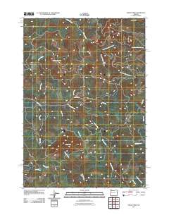
2011 Map of Mount Nebo
USGS Topo · Published 2011About this map
Oshkosh Mountain and its namesake Oshkosh Creek dominate the northwestern reaches of this topographic study, where the landscape is defined by the complex drainage of the Mohawk River system. The confluence of the North Fork Mohawk River and South Fork Mohawk River highlights a network of waterways that shaped the local geography long before modern infrastructure. Central to the map is Mount Nebo, surrounded by smaller tributaries like Nebo Creek and Straight Creek. These features illustrate the deep-cut valleys and ridgelines of Lane County as they appeared in 2011. While largely a natural landscape, the presence of Hatchery Creek and numerous logging or access roads suggests the enduring intersection of the timber industry and environmental management in the Pacific Northwest.
Find a feature on this map
19 named features on this map. Tap any name to fly to it.
Don’t see what you’re looking for? This feature index may not catch every label — zoom into the map to look around manually.
Map Details
Editions of this 2011 Mount Nebo Map
This is the sole edition of this map. No revisions or reprints were ever made.
Other maps of this area

1921 · Brownsville
USGS Topo · 1:62,500

1950 · Marcola
USGS Topo · 1:62,500

1950 · Brownsville
USGS Topo · 1:62,500

1951 · Sweet Home
USGS Topo · 1:62,500

1951 · Leaburg
USGS Topo · 1:62,500

1952 · Brownsville
USGS Topo · 1:62,500

1952 · Marcola
USGS Topo · 1:62,500

1953 · Salem
USGS Topo · 1:250,000

1954 · Salem
USGS Topo · 1:250,000

1960 · Salem
USGS Topo · 1:250,000