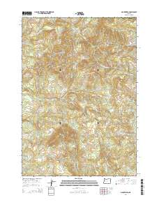
2014 Map of Mount Nebo
USGS Topo · Published 2014About this map
Mount Nebo and Oshkosh Mtn anchor this timbered drainage basin in Lane County, where numerous creeks carve through the steep terrain. The landscape is defined by the convergence of the S Fork Mohawk River and the N Fork Mohawk River, forming the primary Mohawk River system. This 2014 survey illustrates a network of forestry and local roads, including the uniquely named Angels Flight Rd, providing access to the higher elevations.
Find a feature on this map
21 named features on this map. Tap any name to fly to it.
Don’t see what you’re looking for? This feature index may not catch every label — zoom into the map to look around manually.
Map Details
Editions of this 2014 Mount Nebo Map
This is the sole edition of this map. No revisions or reprints were ever made.
Other maps of this area

1921 · Brownsville
USGS Topo · 1:62,500

1950 · Marcola
USGS Topo · 1:62,500

1950 · Brownsville
USGS Topo · 1:62,500

1951 · Sweet Home
USGS Topo · 1:62,500

1951 · Leaburg
USGS Topo · 1:62,500

1952 · Brownsville
USGS Topo · 1:62,500

1952 · Marcola
USGS Topo · 1:62,500

1953 · Salem
USGS Topo · 1:250,000

1954 · Salem
USGS Topo · 1:250,000

1960 · Salem
USGS Topo · 1:250,000