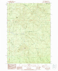
1988 Map of Mount Nebo
USGS Topo · Published 1988About this map
Mt Nebo and Oshkosh Mountain dominate this heavily dissected landscape within the Cascade foothills of Lane County during the late 1980s. The drainage pattern is exceptionally dense, defined by the Mohawk River and its primary tributaries, including the North Fork and South Fork. The map reveals a region defined by industrial forestry and resource extraction, evidenced by numerous sites labeled Quarry and Borrow Pit scattered across the elevations.
Find a feature on this map
25 named features on this map. Tap any name to fly to it.
Don’t see what you’re looking for? This feature index may not catch every label — zoom into the map to look around manually.
Map Details
Editions of this 1988 Mount Nebo Map
This is the sole edition of this map. No revisions or reprints were ever made.
Other maps of this area

1921 · Brownsville
USGS Topo · 1:62,500

1950 · Marcola
USGS Topo · 1:62,500

1950 · Brownsville
USGS Topo · 1:62,500

1951 · Sweet Home
USGS Topo · 1:62,500

1951 · Leaburg
USGS Topo · 1:62,500

1952 · Brownsville
USGS Topo · 1:62,500

1952 · Marcola
USGS Topo · 1:62,500

1953 · Salem
USGS Topo · 1:250,000

1954 · Salem
USGS Topo · 1:250,000

1960 · Salem
USGS Topo · 1:250,000