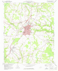
1977 Map of Mount Olive
USGS Topo · Published 1977About this map
The agrarian and educational landscape of Wayne and Duplin Counties is anchored by Mount Olive, where the dual campuses of Mt Olive College and the Jr High Sch define the town's northern core. This 1977 survey illustrates a community deeply tied to its infrastructure and history, with the Seaboard Coast Line railroad cutting a diagonal path through the settlement, parallel to Breazeale Ave. The surrounding countryside is remarkably dense with country churches and cemeteries, such as Mt Gilead Ch and Maplewood Cem, reflecting the area's established social fabric.
Find a feature on this map
65 named features on this map. Tap any name to fly to it.
Don’t see what you’re looking for? This feature index may not catch every label — zoom into the map to look around manually.
Map Details
Editions of this 1977 Mount Olive Map
This is the sole edition of this map. No revisions or reprints were ever made.
Other maps of this area

1953 · Rocky Mount
USGS Topo · 1:250,000

1953 · Raleigh
USGS Topo · 1:250,000

1954 · Rocky Mount
USGS Topo · 1:250,000

1954 · Raleigh
USGS Topo · 1:250,000

1957 · Goldsboro
USGS Topo · 1:62,500

1957 · Seven Springs
USGS Topo · 1:62,500

1974 · Grantham
USGS Topo · 1:24,000

1974 · Southwest Goldsboro
USGS Topo · 1:24,000

1975 · Faison
USGS Topo · 1:24,000
1977 · Warsaw North
USGS Topo · 1:24,000