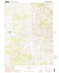
1989 Map of Mount Patterson
USGS Topo · Published 1989About this map
Mount Patterson dominates this high-elevation landscape within the Toiyabe National Forest, where the complex topography of the Sweetwater Mountains straddles the California-Nevada state line. This 1989 survey records a legacy of high-altitude extraction, centering on the Angelo Mission Mine and the Tiger Mines near the summit, while the Kentucky Mine sits further east in Ferris Canyon. These sites are linked by a network of 4WD trails that navigate steep drainages like Silverado Canyon and Cottonwood Canyon.
Find a feature on this map
109 named features on this map. Tap any name to fly to it.
Don’t see what you’re looking for? This feature index may not catch every label — zoom into the map to look around manually.
Map Details
Editions of this 1989 Mount Patterson Map
2 editions found
Other maps of this area

1891 · Wellington
USGS Topo · 1:125,000

1893 · Wellington
USGS Topo · 1:125,000

1909 · Bridgeport
USGS Topo · 1:125,000

1911 · Bridgeport
USGS Topo · 1:125,000

1920 · Bridgeport
USGS Topo · 1:125,000

1948 · Walker Lake
USGS Topo · 1:250,000

1954 · Chris Flat
USGS Topo · 1:24,000

1954 · Fales Hot Springs
USGS Topo · 1:24,000

1956 · Desert Creek Peak
USGS Topo · 1:62,500

1956 · Fales Hot Springs
USGS Topo · 1:62,500