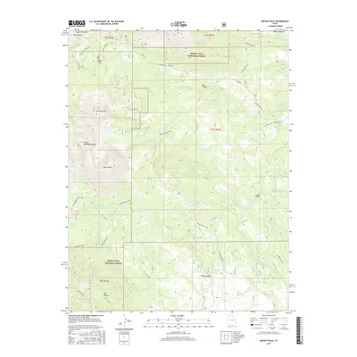
2017 Map of Mount Peale
USGS Topo · Published 2017About this map
Mount Peale dominates the high alpine landscape of the La Sal Mountains in this modern topographical study of San Juan County. Rising above the tree line alongside Mt Mellenthin and Haystack Mtn, the peak anchors a region defined by high-elevation hydrology and recreation. Numerous alpine water bodies including Medicine Lakes, Beaver Lake, and Blue Lake are connected by a network of drainage systems like Geyser Cr and La Sal Cr.
Find a feature on this map
41 named features on this map. Tap any name to fly to it.
Don’t see what you’re looking for? This feature index may not catch every label — zoom into the map to look around manually.
Map Details
Editions of this 2017 Mount Peale Map
This is the sole edition of this map. No revisions or reprints were ever made.
Other maps of this area

1885 · La Sal
USGS Topo · 1:250,000

1954 · Mt Peale 1 SE
USGS Topo · 1:24,000

1954 · Mt Peale 1 NE
USGS Topo · 1:24,000

1954 · Mt. Waas 4 SE
USGS Topo · 1:24,000

1954 · Mt. Waas 4 SW
USGS Topo · 1:24,000

1954 · Mt Peale 1 SW
USGS Topo · 1:24,000

1954 · Mt Peale 1 NW
USGS Topo · 1:24,000

1954 · Mt Peale 2 SE
USGS Topo · 1:24,000

1954 · Mt. Waas 3 SE
USGS Topo · 1:24,000

1954 · Mt Peale 2 NE
USGS Topo · 1:24,000