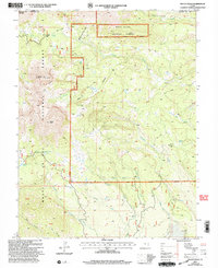
2001 Map of Mount Peale
USGS Topo · Published 2004About this map
La Sal Mountains dominate this high-altitude landscape along the border of Grand and San Juan Counties, featuring prominent peaks like Mount Peale and Mount Mellenthin. Managed by the Moab Ranger District of the Manti-La Sal National Forest, the area is defined by a network of drainage systems and high alpine water sources. Significant hydrologic features include the Beaver Lake (Medicine Lake) complex and Dark Canyon Lake, which feed into various creeks such as Twomile Creek and Beaver Creek.
Find a feature on this map
33 named features on this map. Tap any name to fly to it.
Don’t see what you’re looking for? This feature index may not catch every label — zoom into the map to look around manually.
Map Details
Editions of this 2001 Mount Peale Map
This is the sole edition of this map. No revisions or reprints were ever made.
Other maps of this area

1885 · La Sal
USGS Topo · 1:250,000

1954 · Mt Peale 1 SE
USGS Topo · 1:24,000

1954 · Mt Peale 1 NE
USGS Topo · 1:24,000

1954 · Mt. Waas 4 SE
USGS Topo · 1:24,000

1954 · Mt. Waas 4 SW
USGS Topo · 1:24,000

1954 · Mt Peale 1 SW
USGS Topo · 1:24,000

1954 · Mt Peale 1 NW
USGS Topo · 1:24,000

1954 · Mt Peale 2 SE
USGS Topo · 1:24,000

1954 · Mt. Waas 3 SE
USGS Topo · 1:24,000

1954 · Mt Peale 2 NE
USGS Topo · 1:24,000