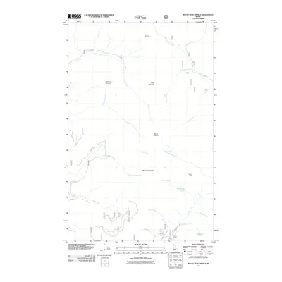
2011 Map of Mount Pend Oreille
USGS Topo · Published 2011About this map
Mount Pend Oreille dominates this high-elevation corner of Bonner County, where the Cabinet Mountains create a complex network of drainages and peaks. The map reveals a landscape defined by its alpine hydrology and isolation, featuring the headwaters of Rapid Lightning Creek, Lightning Creek, and Trapper Creek. These waterways originate from high basins, including the waters of Lake Darling and Gem Lake near the southern edge. The presence of the Dougherty Mine and Smith Cabin indicates a history of resource extraction and seasonal habitation tucked away in the steep terrain. Access to this region in the early 21st century relied on a network of Forest Service roads such as Grouse Creek Rd, Van Dyke Rd, and Stove Rd, which follow the narrow valley floors between heights like Strawberry Mountain and Purdy Mountain.
Find a feature on this map
32 named features on this map. Tap any name to fly to it.
Don’t see what you’re looking for? This feature index may not catch every label — zoom into the map to look around manually.
Map Details
Editions of this 2011 Mount Pend Oreille Map
This is the sole edition of this map. No revisions or reprints were ever made.
Other maps of this area

1911 · Priest Lake
USGS Topo · 1:250,000

1913 · Priest Lake
USGS Topo · 1:250,000

1951 · Mt Pend Oreille
USGS Topo · 1:62,500

1951 · Elmira
USGS Topo · 1:62,500

1958 · Sandpoint
USGS Topo · 1:250,000

1963 · Sandpoint
USGS Topo · 1:250,000
1965 · Leonia
USGS Topo · 1:24,000

1965 · Twentymile Creek
USGS Topo · 1:24,000
1965 · Clifty Mtn
USGS Topo · 1:24,000
1983 · Bonners Ferry
USGS Topo · 1:100,000