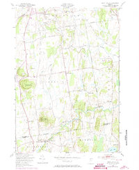
1948 Map of Mount Philo
USGS Topo · Published 1973About this map
Shelburne Falls and the agricultural lands of the Champlain Valley are captured here just after the war, showing a landscape defined by small crossroads settlements and rural schoolhouses. The terrain is dominated by prominent elevations like Mount Philo, complete with its summit Beacon, and Pease Mountain. Local education was still decentralized at this time, evidenced by several district-style buildings such as New Palmer Sch, Prindle Sch, and Mount Philo Sch scattered across the townships.
Find a feature on this map
33 named features on this map. Tap any name to fly to it.
Don’t see what you’re looking for? This feature index may not catch every label — zoom into the map to look around manually.
Map Details
Editions of this 1948 Mount Philo Map
4 editions found

Other maps of this area

1894 · Port Henry
USGS Topo · 1:62,500

1895 · Willsboro
USGS Topo · 1:62,500

1898 · Port Henry
USGS Topo · 1:62,500

1903 · Middlebury
USGS Topo · 1:62,500

1905 · Middlebury
USGS Topo · 1:62,500

1906 · Burlington
USGS Topo · 1:62,500

1919 · Burlington
USGS Topo · 1:62,500

1920 · Middlebury
USGS Topo · 1:62,500

1941 · Willsboro
USGS Topo · 1:62,500

1943 · Willsboro
USGS Topo · 1:62,500