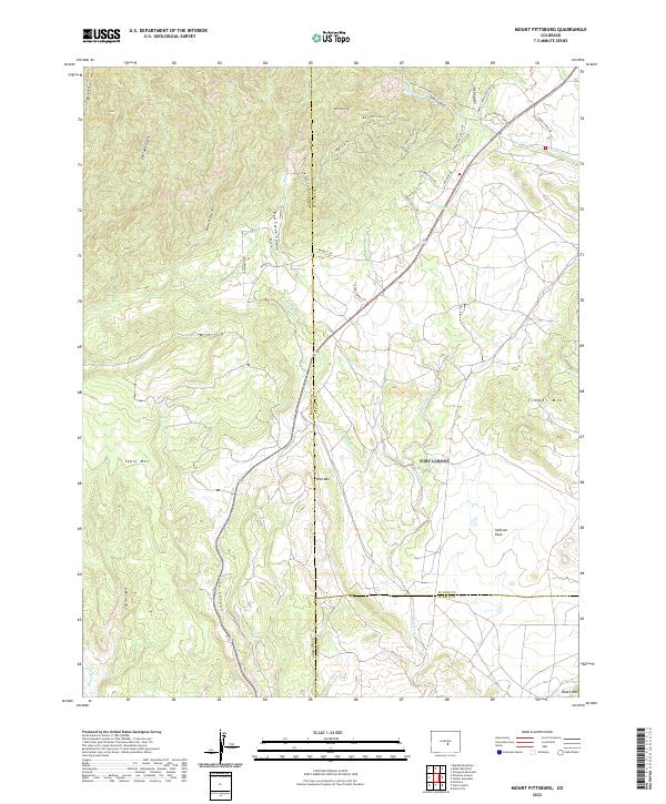
2022 Map of Mount Pittsburg
USGS Topo · Published 2022About this map
The dramatic geography of Mt Pittsburg and the surrounding high-elevation peaks defines this modern landscape where Fremont, El Paso, and Pueblo counties converge. This high-country terrain is deeply etched by watercourses such as Turkey Cr and the various branches of Red Creek, which carve through deep formations like Red Creek Canyon. The map reveals a land divided between the expansive, relatively flat Sullivan Park and the prominent rising masses of Table Mtn and Timber Mtn. Modern residential and ranch development is evident through named roads like Turkey Canyon Ranch Rd and Henry Ride Hts, showing how contemporary settlement has adapted to the steep drainages of Banta Gulch and Patton Canyon. This 2022 survey provides an exceptionally clear record of the intersection between private land access and the protected backcountry south of the Pikes Peak region.
Find a feature on this map
48 named features on this map. Tap any name to fly to it.
Don’t see what you’re looking for? This feature index may not catch every label — zoom into the map to look around manually.
Map Details
Editions of this 2022 Mount Pittsburg Map
This is the sole edition of this map. No revisions or reprints were ever made.
Other maps of this area

1889 · Canon City
USGS Topo · 1:125,000

1891 · Pueblo
USGS Topo · 1:125,000

1892 · Canon City
USGS Topo · 1:125,000

1893 · Colorado Springs
USGS Topo · 1:125,000

1894 · Pikes Peak
USGS Topo · 1:125,000

1894 · Pueblo
USGS Topo · 1:125,000

1896 · Pueblo
USGS Topo · 1:125,000

1897 · Pueblo
USGS Topo · 1:125,000

1901 · Pikes Peak
USGS Topo · 1:125,000

1909 · Colorado Springs
USGS Topo · 1:125,000