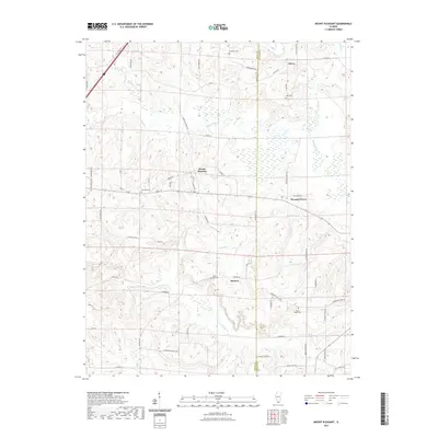
2021 Map of Mount Pleasant
USGS Topo · Published 2021About this map
The Union Co and Johnson Co line divides this Southern Illinois landscape, where small rural settlements like Moscow and Mount Pleasant are connected by a network of winding county roads. The terrain is defined by the drainage of the Cache River, which is fed by numerous smaller waterways including Cypress Cr and Buck Run. Local history is anchored by a significant number of family and community burial grounds, such as Goddard Cem and Allen Cem, which are often located near old crossroads or church sites like Mount Pisgah Cem. North of Pleasant Grove, the map shows a landscape of ridges and lowlands typical of the region's diverse topography. This modern survey provides a detailed view of current property boundaries and road networks like Lick Creek Rd and Elvira Rd, which continue to shape the character of these unincorporated communities.
Find a feature on this map
65 named features on this map. Tap any name to fly to it.
Don’t see what you’re looking for? This feature index may not catch every label — zoom into the map to look around manually.
Map Details
Editions of this 2021 Mount Pleasant Map
This is the sole edition of this map. No revisions or reprints were ever made.
Other maps of this area

1918 · Vienna
USGS Topo · 1:62,500

1919 · Vienna
USGS Topo · 1:62,500

1920 · Dongola
USGS Topo · 1:62,500

1922 · Carbondale
USGS Topo · 1:62,500

1923 · Dongola
USGS Topo · 1:62,500

1925 · Marion
USGS Topo · 1:62,500

1940 · Marion
USGS Topo · 1:62,500

1941 · Carbondale
USGS Topo · 1:62,500

1942 · Vienna
USGS Topo · 1:62,500

1949 · Paducah
USGS Topo · 1:250,000