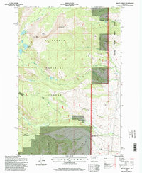
1996 Map of Mount Powell
USGS Topo · Published 1998About this map
Deer Lodge National Forest dominates this high-altitude landscape, where the peaks of Mount Powell and Deer Lodge Mountain tower over a complex network of glacial basins and alpine lakes. The eastern edge of the quadrangle is defined by the Montana State Prison Ranch Boundary, illustrating a unique intersection of public forest land and state correctional facility operations in the late 20th century. High-elevation features like The Crater and South America Park suggest a terrain carved by significant geological activity.
Find a feature on this map
38 named features on this map. Tap any name to fly to it.
Don’t see what you’re looking for? This feature index may not catch every label — zoom into the map to look around manually.
Map Details
Editions of this 1996 Mount Powell Map
This is the sole edition of this map. No revisions or reprints were ever made.
Other maps of this area

1889 · Helena
USGS Topo · 1:250,000

1893 · Helena
USGS Topo · 1:250,000

1899 · Helena
USGS Topo · 1:250,000

1903 · Helena
USGS Topo · 1:250,000

1908 · Philipsburg
USGS Topo · 1:125,000

1947 · Butte
USGS Topo · 1:250,000

1958 · Butte
USGS Topo · 1:250,000

1960 · Butte
USGS Topo · 1:250,000

1961 · Anaconda
USGS Topo · 1:62,500

1962 · Butte
USGS Topo · 1:250,000