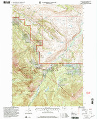
2000 Map of Mount Rae
USGS Topo · Published 2005About this map
The Livingston Ranger District and Big Timber Ranger District meet in this landscape of high plateaus and ranching history. The terrain is divided by the Boulder Divide, which separates the drainages of Little Mission Creek and the West Boulder River. For genealogists and local historians, the map is remarkably dense with named residences and agricultural outposts, including the Swingley Ranch, Richards Ranch, and Burnt Leather Ranch.
Find a feature on this map
52 named features on this map. Tap any name to fly to it.
Don’t see what you’re looking for? This feature index may not catch every label — zoom into the map to look around manually.
Map Details
Editions of this 2000 Mount Rae Map
This is the sole edition of this map. No revisions or reprints were ever made.
Other maps of this area

1891 · Livingston
USGS Topo · 1:250,000

1893 · Livingston
USGS Topo · 1:250,000

1940 · Mt. Cowen
USGS Topo · 1:62,500

1941 · Mt Douglas
USGS Topo · 1:62,500

1943 · Mt Douglas
USGS Topo · 1:62,500

1943 · Mt Cowen
USGS Topo · 1:62,500

1947 · Bozeman
USGS Topo · 1:250,000

1948 · Bozeman
USGS Topo · 1:250,000

1951 · Mount Rae
USGS Topo · 1:24,000

1951 · Livingston Peak
USGS Topo · 1:24,000