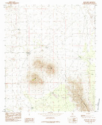
1985 Map of Mount Riley
USGS Topo · Published 1985About this map
Mount Riley and the adjacent Cox Peak dominate this arid landscape within the East Potrillo Mountains of southern New Mexico. This 1985 provisional survey, compiled from mid-1970s aerial photography, documents a terrain defined by volcanic features and water scarcity. Human activity is sparse, marked primarily by scattered prospects that hint at mineral exploration in the mountain foothills.
Find a feature on this map
10 named features on this map. Tap any name to fly to it.
Don’t see what you’re looking for? This feature index may not catch every label — zoom into the map to look around manually.
Map Details
Editions of this 1985 Mount Riley Map
This is the sole edition of this map. No revisions or reprints were ever made.
Other maps of this area

1891 · Las Cruces
USGS Topo · 1:125,000

1893 · Las Cruces
USGS Topo · 1:125,000

1917 · Noria
USGS Topo · 1:62,500

1917 · Mt. Riley
USGS Topo · 1:62,500

1918 · Mt. Riley
USGS Topo · 1:62,500

1918 · Noria
USGS Topo · 1:62,500

1929 · Mt. Riley
USGS Topo · 1:62,500

1941 · Aden
USGS Topo · 1:62,500

1943 · Aden
USGS Topo · 1:62,500

1943 · Afton
USGS Topo · 1:62,500