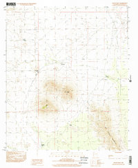
1996 Map of Mount Riley
USGS Topo · Published 2002About this map
Mount Riley and Cox Peak dominate this arid landscape in Doña Ana County, rising as prominent volcanic landmarks above the desert floor. This 1996 provisional survey illustrates a terrain defined by water scarcity and resource extraction, where life and movement revolve around scattered catchments such as Davids Tank, Twin Tanks, and Rattlesnake Tank. To the southeast, the slopes of the East Potrillo Mountains reveal several prospects, indicating a history of mineral exploration in these remote uplands. The absence of established towns or paved roads emphasizes the isolated character of the borderlands during the late twentieth century, with only unimproved tracks connecting features like Chalk Tank and Gap Tank. The map provides a precise record of the natural topography and the sparse human infrastructure required for ranching and mining in the Chihuahuan Desert.
Find a feature on this map
10 named features on this map. Tap any name to fly to it.
Don’t see what you’re looking for? This feature index may not catch every label — zoom into the map to look around manually.
Map Details
Editions of this 1996 Mount Riley Map
This is the sole edition of this map. No revisions or reprints were ever made.
Other maps of this area

1891 · Las Cruces
USGS Topo · 1:125,000

1893 · Las Cruces
USGS Topo · 1:125,000

1917 · Noria
USGS Topo · 1:62,500

1917 · Mt. Riley
USGS Topo · 1:62,500

1918 · Mt. Riley
USGS Topo · 1:62,500

1918 · Noria
USGS Topo · 1:62,500

1929 · Mt. Riley
USGS Topo · 1:62,500

1941 · Aden
USGS Topo · 1:62,500

1943 · Aden
USGS Topo · 1:62,500

1943 · Afton
USGS Topo · 1:62,500