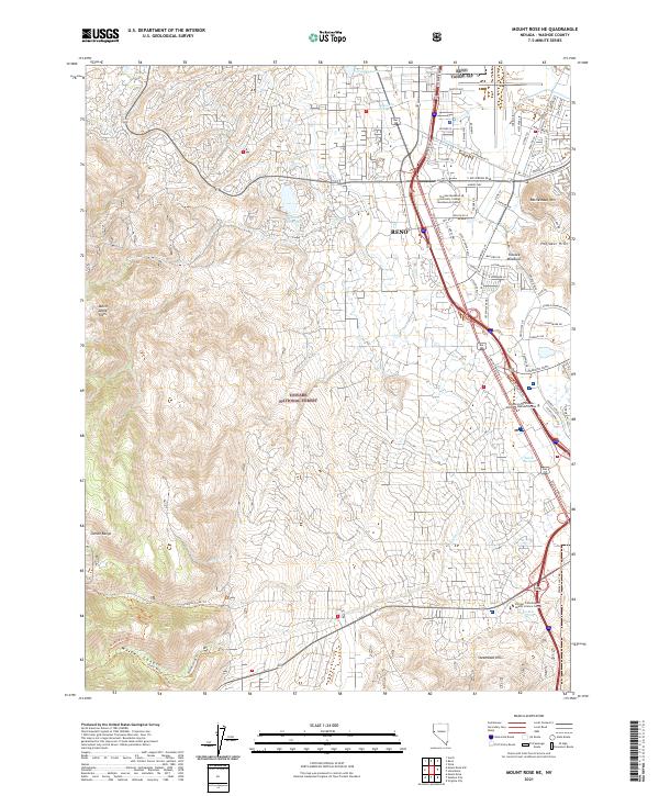
2021 Map of Mount Rose NE
USGS Topo · Published 2021About this map
Reno and its southern extensions dominate the landscape of this 2021 survey, where urban infrastructure meets the eastern slopes of the Carson Range. The transition from the dense street grids of Reno to the preserved lands of the Toiyabe National Forest is clearly visible, showing how modern development has pressed against the high terrain of Whites Canyon and Steamboat Hills. Significant institutional landmarks, including the Reno Tahoe IAP and the University of Phoenix - Northern Nevada Campus, mark the valley floor, while water features like the Cochran Ditch and Virginia Lake illustrate the area's managed irrigation and recreation history.
Find a feature on this map
48 named features on this map. Tap any name to fly to it.
Don’t see what you’re looking for? This feature index may not catch every label — zoom into the map to look around manually.
Map Details
Editions of this 2021 Mount Rose NE Map
This is the sole edition of this map. No revisions or reprints were ever made.
Other maps of this area

1891 · Carson
USGS Topo · 1:125,000

1891 · Reno
USGS Topo · 1:125,000

1893 · Carson
USGS Topo · 1:125,000

1893 · Reno
USGS Topo · 1:125,000

1950 · Virginia City
USGS Topo · 1:62,500

1950 · Mt. Rose
USGS Topo · 1:62,500

1950 · Reno
USGS Topo · 1:62,500

1951 · Reno
USGS Topo · 1:62,500

1952 · Mt. Rose
USGS Topo · 1:62,500

1952 · Virginia City
USGS Topo · 1:62,500