
1952 Map of Virginia City
USGS Topo · Published 1952About this map
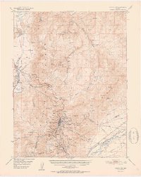
The Comstock Lode mining landscape is captured in meticulous detail on this 1952 study, showing the density of shafts, tunnels, and historic settlements along the Virginia Range. Virginia City serves as the focal point, with its complex network of streets and nearby industrial landmarks such as Mt Davidson and Ophir Hill. To the south, the gold and silver legacy continues through Gold Hill and Silver City, down into American Flat. A primary engineering marvel of the era, the Sutro Tunnel, is traced from the mines toward its outlet near the Sutro (Site). The map also documents the transition of transportation, from the winding Geiger Grade to a Dismantled RR following the Carson River. This survey preserves the locations of early educational and social sites like Browns Sch and various Cem plots essential for genealogical research.
Find a feature on this map
54 named features on this map. Tap any name to fly to it.
Don’t see what you’re looking for? This feature index may not catch every label — zoom into the map to look around manually.
Map Details
Editions of this 1952 Virginia City Map
2 editions found
Other maps of this area

1890 · Wadsworth
USGS Topo · 1:125,000

1891 · Carson
USGS Topo · 1:125,000

1891 · Wabuska
USGS Topo · 1:125,000

1891 · Reno
USGS Topo · 1:125,000

1892 · Wadsworth
USGS Topo · 1:125,000

1893 · Carson
USGS Topo · 1:125,000

1893 · Reno
USGS Topo · 1:125,000

1894 · Wadsworth
USGS Topo · 1:125,000

1894 · Wabuska
USGS Topo · 1:125,000

1950 · Virginia City
USGS Topo · 1:62,500