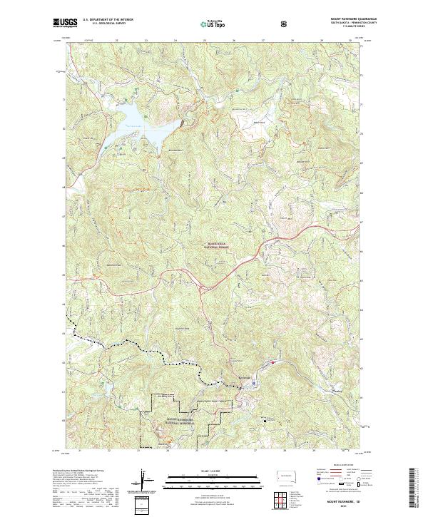
2021 Map of Mount Rushmore
USGS Topo · Published 2021About this map
The town of Keystone and the iconic Mt Rushmore define this landscape within the Black Hills National Forest. This modern record of the central Black Hills highlights the enduring network of historic paths, notably the extensive Centennial Trail and the Flume Trail, which follows the route of the historic Rockerville Flume. These trails wind through a high-relief terrain of named peaks including Samelius Peak, Old Baldy Mtn, and Hardesty Peak, while the northern portion of the map is dominated by the waters of Sheridan Lake. The map reveals the area's mining legacy near the town center, specifically the Miner's Gateway Tunnel and several named gulches like Bobtail Gulch and Horsefly Gulch. In the southeastern corner, the Mountain View Cem sits near Grizzly Bear Cr, providing a clear connection for those researching the local families of this legendary South Dakota mining district.
Find a feature on this map
112 named features on this map. Tap any name to fly to it.
Don’t see what you’re looking for? This feature index may not catch every label — zoom into the map to look around manually.
Map Details
Editions of this 2021 Mount Rushmore Map
This is the sole edition of this map. No revisions or reprints were ever made.
Other maps of this area

1893 · Rapid
USGS Topo · 1:125,000

1894 · Deadwood
USGS Topo · 1:125,000

1894 · Hermosa
USGS Topo · 1:125,000

1896 · Harney Peak
USGS Topo · 1:125,000

1898 · Rapid
USGS Topo · 1:125,000

1901 · Hermosa
USGS Topo · 1:125,000

1901 · Harney Peak
USGS Topo · 1:125,000

1901 · Deadwood
USGS Topo · 1:125,000

1903 · Rapid
USGS Topo · 1:125,000

1916 · Deadwood
USGS Topo · 1:125,000