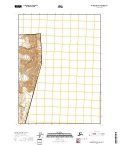
2018 Map of Mount Saint Elias B-3 SW
USGS Topo · Published 2018About this map
The United States-Canada boundary defines the eastern edge of this high-altitude terrain, where the peaks of the Saint Elias Mountains rise dramatically along the border. This 2018 survey reveals the ice-dominated landscape of Wrangell-Saint Elias National Park, a region characterized by the movement of massive ice sheets. Significant geological features include the Alverstone Glacier and the Hubbard Glacier, which feed through the complex topography of the mountain range. Near the northern boundary, Mt Alverstone stands as a prominent summit, while Mt Hubbard overlooks the international line further south. The map provides precise contour data for these extreme elevations, showing the immense physical barriers that have historically dictated the boundary surveying and exploration of the Alaskan interior.
Find a feature on this map
11 named features on this map. Tap any name to fly to it.
Don’t see what you’re looking for? This feature index may not catch every label — zoom into the map to look around manually.
Map Details
Editions of this 2018 Mount Saint Elias B-3 SW Map
This is the sole edition of this map. No revisions or reprints were ever made.
Other maps of this area

1951 · Mt Saint Elias
USGS Topo · 1:250,000

1959 · Mt Saint Elias
USGS Topo · 1:250,000
1985 · Mount Saint Elias B-4
USGS Topo · 1:63,360
1985 · Mount Saint Elias A-4
USGS Topo · 1:63,360
1985 · Mount Saint Elias B-3
USGS Topo · 1:63,360
1985 · Mount Saint Elias A-3
USGS Topo · 1:63,360
2017 · Mount Saint Elias A-4 NE
USGS Topo · 1:25,000
2017 · Mount Saint Elias B-4 SE
USGS Topo · 1:25,000
2018 · Mount Saint Elias A-3 NW
USGS Topo · 1:25,000