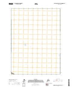
2017 Map of Mount Saint Elias B-7 OE E SW
USGS Topo · Published 2017About this map
The international border between Canada and the Usa defines the extreme southwestern corner of this survey, which covers a largely unrecorded and label-sparse portion of the Yakutat City and Borough. While this 2017 edition by the U.S. Geological Survey provides precise geographic coordinates and a standard Universal Transverse Mercator grid, the landscape remains primarily focused on the physical geometry of the border. The absence of named settlements, roads, or industrial landmarks highlights the isolation of this corner of Alaska at the beginning of the twenty-first century, offering a blank canvas of the high-latitude frontier for those studying the delineation of the northern boundary.
Find a feature on this map
1 named feature on this map. Tap any name to fly to it.
Don’t see what you’re looking for? This feature index may not catch every label — zoom into the map to look around manually.
Map Details
Editions of this 2017 Mount Saint Elias B-7 OE E SW Map
This is the sole edition of this map. No revisions or reprints were ever made.
Other maps of this area

1951 · Mt Saint Elias
USGS Topo · 1:250,000

1959 · Mt Saint Elias
USGS Topo · 1:250,000
1985 · Mount Saint Elias A-7
USGS Topo · 1:63,360
1985 · Mount Saint Elias B-7
USGS Topo · 1:63,360
1985 · Mount Saint Elias A-6
USGS Topo · 1:63,360
2017 · Mount Saint Elias A-6 NE
USGS Topo · 1:25,000
2017 · Mount Saint Elias B-7 SE
USGS Topo · 1:25,000
2017 · Mount Saint Elias A-7 NE
USGS Topo · 1:25,000
2017 · Mount Saint Elias A-6 NW
USGS Topo · 1:25,000