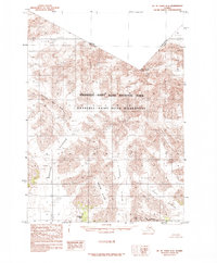
1985 Map of Mount Saint Elias A-6
USGS Topo · Published 1985About this map
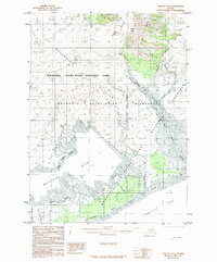
Mount Cook towers over a landscape dominated by massive ice flows and glacial action along the international border in the mid-1980s. This survey records the frozen expanse of the Wrangell - Saint Elias National Park, where the Blossom Glacier and Hayden Glacier converge near the high-relief terrain of the Pinnacle Pass Hills. The cartography emphasizes the complex movement of ice, detailing the Moraine deposits left by receding fronts. Notable landmarks such as Blossom Island and the Floral Hills emerge from the ice, providing fixed points for navigators and glaciologists studying the shifting Marvine Glacier and Lucia Glacier. The boundary between the United States and Canada is clearly delineated across the high peaks of the Saint Elias Mountains.
Find a feature on this map
19 named features on this map. Tap any name to fly to it.
Don’t see what you’re looking for? This feature index may not catch every label — zoom into the map to look around manually.
Map Details
Editions of this 1985 Mount Saint Elias A-6 Map
This is the sole edition of this map. No revisions or reprints were ever made.
Other maps of this area

1951 · Yakutat
USGS Topo · 1:250,000

1951 · Mt Saint Elias
USGS Topo · 1:250,000

1959 · Yakutat D-5
USGS Topo · 1:63,360

1959 · Yakutat
USGS Topo · 1:250,000

1959 · Mt Saint Elias
USGS Topo · 1:250,000
1985 · Mount Saint Elias A-7
USGS Topo · 1:63,360
1985 · Mount Saint Elias B-7
USGS Topo · 1:63,360
1985 · Mount Saint Elias A-5
USGS Topo · 1:63,360
1985 · Yakutat D-6
USGS Topo · 1:63,360
1985 · Mount Saint Elias B-5
USGS Topo · 1:63,360