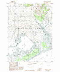
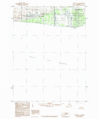
1985 Map of Yakutat D-6
USGS Topo · Published 1985About this map
Malaspina Glacier dominates this mid-1980s topographic study, showing a massive ice field as it appeared during the transition to federal management within the Wrangell - Saint Elias National Park system. The map details a complex hydrologic network where glacial meltwater feeds into Malaspina Lake and numerous glacial streams, including Kwik Stream, Flora Stream, and Sudden Stream. Along the southern coastline, the survey identifies Schooner Beach fronting Yakutat Bay, providing a clear view of the relationship between high-altitude ice sheets and the Pacific shoreline. This era of mapping marks the formalization of land use boundaries, clearly delineating the Wrangell - Saint Elias Wilderness and Wrangell - Saint Elias National Preserve boundaries across the glacial moraine. Geologic markers such as the Hayden Glacier and the lonely Lucia Nunatak are carefully plotted, illustrating the shifting ice and rock of the Alaskan coast.
Find a feature on this map
21 named features on this map. Tap any name to fly to it.
Don’t see what you’re looking for? This feature index may not catch every label — zoom into the map to look around manually.
Map Details
Editions of this 1985 Yakutat D-6 Map
This is the sole edition of this map. No revisions or reprints were ever made.
Other maps of this area

1951 · Yakutat
USGS Topo · 1:250,000

1951 · Mt Saint Elias
USGS Topo · 1:250,000

1959 · Yakutat C-5
USGS Topo · 1:63,360

1959 · Yakutat D-5
USGS Topo · 1:63,360

1959 · Yakutat
USGS Topo · 1:250,000

1959 · Mt Saint Elias
USGS Topo · 1:250,000
1985 · Mount Saint Elias A-7
USGS Topo · 1:63,360
1985 · Mount Saint Elias A-5
USGS Topo · 1:63,360
1985 · Yakutat C-6
USGS Topo · 1:63,360
1985 · Yakutat C-7
USGS Topo · 1:63,360