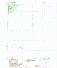
1985 Map of Yakutat C-6
USGS Topo · Published 1985About this map
Wrangell-Saint Elias National Preserve occupies the northwestern corner of this coastal sheet, where the terrestrial wilderness meets the open waters of the Gulf of Alaska. Compiled from 1958 photography, the map documents a largely untouched maritime environment dominated by the expanse of Yakutat Bay. The terrain features the Osar Stream and the Malaspina SW Base, a surveying landmark positioned near the shoreline. The vast majority of the quadrangle is defined by the water of the gulf, illustrating the scale of the North Pacific coastline and the proximity of the coastal ranges to the sea. The sparse nomenclature reflects the wild character of this region during the mid-20th century, highlighting only the most essential hydrographic and topographic reference points within the national preserve boundaries.
Find a feature on this map
7 named features on this map. Tap any name to fly to it.
Don’t see what you’re looking for? This feature index may not catch every label — zoom into the map to look around manually.
Map Details
Editions of this 1985 Yakutat C-6 Map
This is the sole edition of this map. No revisions or reprints were ever made.
Other maps of this area

1951 · Yakutat
USGS Topo · 1:250,000

1959 · Yakutat B-5
USGS Topo · 1:63,360

1959 · Yakutat C-5
USGS Topo · 1:63,360

1959 · Yakutat D-5
USGS Topo · 1:63,360

1959 · Yakutat
USGS Topo · 1:250,000
1985 · Yakutat D-6
USGS Topo · 1:63,360
1985 · Yakutat C-7
USGS Topo · 1:63,360
1985 · Yakutat D-7
USGS Topo · 1:63,360
1987 · Yakutat C-5 SW
USGS Topo · 1:25,000
1996 · Yakutat C-5
USGS Topo · 1:63,360