
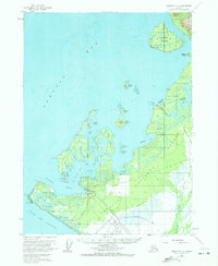
1959 Map of Yakutat C-5
USGS Topo · Published 1963About this map
Yakutat serves as the focal point for this coastal survey, situated at the entrance to Monti Bay along the southeastern coast of Alaska. The landscape is defined by an intricate network of waterways and islands, including the large Khantaak Island and the smaller Dolgoi Island and Kriwoi Island clustered in the Yakutat Roads passage. On the mainland, the Yakutat and Southern rail line cuts through the Tongass National Forest, connecting the settlement to the Yakutat Airport and the resource-rich areas near the Situk River.
Find a feature on this map
56 named features on this map. Tap any name to fly to it.
Don’t see what you’re looking for? This feature index may not catch every label — zoom into the map to look around manually.
Map Details
Editions of this 1959 Yakutat C-5 Map
2 editions found
Other maps of this area

1951 · Yakutat
USGS Topo · 1:250,000

1959 · Yakutat B-5
USGS Topo · 1:63,360

1959 · Yakutat D-4
USGS Topo · 1:63,360

1959 · Yakutat C-4
USGS Topo · 1:63,360

1959 · Yakutat B-4
USGS Topo · 1:63,360

1959 · Yakutat D-5
USGS Topo · 1:63,360

1959 · Yakutat
USGS Topo · 1:250,000
1985 · Yakutat D-6
USGS Topo · 1:63,360
1985 · Yakutat C-6
USGS Topo · 1:63,360

1987 · Yakutat C-4 SW
USGS Topo · 1:25,000