
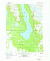
1959 Map of Yakutat C-4
USGS Topo · Published 1963About this map
Russell Fiord dominates this portion of the Tongass National Forest, illustrating the dramatic glaciated landscape of the Yakutat Forelands in the late 1950s. The map reveals a complex hydrographic system where the Situk River and Old Situk Creek drain the coastal lowlands, while massive ice features like Hidden Glacier and the Rasmussen Gl descend from peaks such as Mount Tebenkof and Mount Ruhamah.
Find a feature on this map
20 named features on this map. Tap any name to fly to it.
Don’t see what you’re looking for? This feature index may not catch every label — zoom into the map to look around manually.
Map Details
Editions of this 1959 Yakutat C-4 Map
2 editions found
Other maps of this area

1951 · Yakutat
USGS Topo · 1:250,000

1959 · Yakutat C-3
USGS Topo · 1:63,360

1959 · Yakutat B-5
USGS Topo · 1:63,360

1959 · Yakutat D-3
USGS Topo · 1:63,360

1959 · Yakutat C-5
USGS Topo · 1:63,360

1959 · Yakutat D-4
USGS Topo · 1:63,360

1959 · Yakutat B-3
USGS Topo · 1:63,360

1959 · Yakutat B-4
USGS Topo · 1:63,360

1959 · Yakutat D-5
USGS Topo · 1:63,360

1959 · Yakutat
USGS Topo · 1:250,000