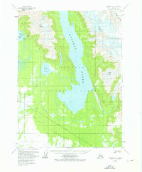
1959 Map of Yakutat C-4
USGS Topo · Published 1976About this map
Russell Fiord and the surrounding wilderness of the Tongass National Forest dominate this mid-century topographic survey. The landscape is defined by massive ice features like the Hidden Glacier and Fourth Glacier, which carve through peaks such as Mount Tebenkof and Mount Ruhamah. Coastal features including Eleanor Island, Shelter Cove, and Chicago Harbor illustrate the complex shoreline of the Yakutat region.
Find a feature on this map
22 named features on this map. Tap any name to fly to it.
Don’t see what you’re looking for? This feature index may not catch every label — zoom into the map to look around manually.
Map Details
Editions of this 1959 Yakutat C-4 Map
2 editions found
Other maps of this area

1951 · Yakutat
USGS Topo · 1:250,000

1959 · Yakutat C-3
USGS Topo · 1:63,360

1959 · Yakutat B-5
USGS Topo · 1:63,360

1959 · Yakutat D-3
USGS Topo · 1:63,360

1959 · Yakutat C-5
USGS Topo · 1:63,360

1959 · Yakutat D-4
USGS Topo · 1:63,360

1959 · Yakutat C-4
USGS Topo · 1:63,360

1959 · Yakutat B-3
USGS Topo · 1:63,360

1959 · Yakutat B-4
USGS Topo · 1:63,360

1959 · Yakutat D-5
USGS Topo · 1:63,360