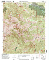
1995 Map of Mount San Antonio
USGS Topo · Published 1999About this map
High-altitude landscapes dominate this revision of the eastern San Gabriel Mountains, centered on the towering Mount San Antonio and the recreational corridors along Blue Ridge. The map documents a significant intersection of conservation and industry, where the Sheep Mountain Wilderness meets legacy mining operations. Gold-seeking history is etched into the canyons at the Big Horn Mine and Stanley Miller Mine, while the growing winter sports economy is visible at the Mount High East Ski Area and Mount High West Ski Area. Near the settlement of Wrightwood, the winding path of the Pacific Crest National Scenic Trail traverses the divide between the Angeles National Forest and the San Bernardino National Forest, illustrating the complex management of this high-elevation backcountry in the mid-1990s.
Find a feature on this map
48 named features on this map. Tap any name to fly to it.
Don’t see what you’re looking for? This feature index may not catch every label — zoom into the map to look around manually.
Map Details
Editions of this 1995 Mount San Antonio Map
This is the sole edition of this map. No revisions or reprints were ever made.
Other maps of this area

1894 · Pomona
USGS Topo · 1:62,500

1897 · Pomona
USGS Topo · 1:62,500

1897 · Cucamonga
USGS Topo · 1:62,500

1898 · Pomona
USGS Topo · 1:62,500

1900 · Cucamonga
USGS Topo · 1:62,500

1901 · Southern California Sheet No. 1
USGS Topo · 1:250,000

1903 · Rock Creek
USGS Topo · 1:62,500

1903 · Cucamonga
USGS Topo · 1:62,500

1903 · San Antonio
USGS Topo · 1:62,500

1904 · Pomona
USGS Topo · 1:62,500