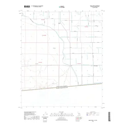
2018 Map of Mount Signal
USGS Topo · Published 2018About this map
Imperial Valley irrigation infrastructure dominates this borderlands landscape, where a dense network of man-made waterways supports agriculture right up to the international boundary. The settlement of Mount Signal sits at the nexus of several vital water routes, including the Woodbine Canal and the Brockman Drain. The transition from the cultivated fields of the valley to the arid terrain of the Yuha Desert and West Mesa is sharp, marked by the western reach of the canal systems. Along the southern edge, the border between the United States of America and Estados Unidos Mexicanos is clearly delineated, running south of Signal Rd. The presence of numerous named drains such as the Wixom Drain and Martin-Drain, alongside larger features like the New River, illustrates the complex engineering required to manage water in this desert environment during the early 21st century.
Find a feature on this map
76 named features on this map. Tap any name to fly to it.
Don’t see what you’re looking for? This feature index may not catch every label — zoom into the map to look around manually.
Map Details
Editions of this 2018 Mount Signal Map
This is the sole edition of this map. No revisions or reprints were ever made.
Other maps of this area

1915 · El Centro
USGS Topo · 1:125,000

1940 · Brawley
USGS Topo · 1:62,500

1940 · Heber
USGS Topo · 1:62,500

1940 · Plaster City
USGS Topo · 1:62,500

1940 · Coyote Wells
USGS Topo · 1:62,500

1942 · El Centro
USGS Topo · 1:250,000

1943 · Coyote Wells
USGS Topo · 1:62,500

1943 · Heber
USGS Topo · 1:62,500

1943 · Brawley
USGS Topo · 1:62,500

1944 · Plaster City
USGS Topo · 1:62,500