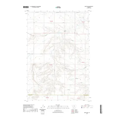
2020 Map of Mount Sinai
USGS Topo · Published 2020About this map
Mt Sinai rises as a prominent landmark in this upland region where the borders of Stillwater and Golden Valley counties meet. The landscape is defined by a series of drainages, including the meandering path of Big Coulee Cr to the north and the complex draws of Cabin Gulch and Stockade Gulch. These natural features dictated the placement of local thoroughfares such as Shifley Rd and Custer Gulch Rd, which follow the contours of the high plains terrain. The presence of several family-named roads, including Sherod Rd, Kunesh Rd, and Van Der Voort Rd, provides a clear view into the rural property divisions and settlement history of this part of Montana in the early twenty-first century. Minor waterways like Custer Cr and Cabin Gulch Cr further dissect the land, showing the subtle but important water sources in this dry environment.
Find a feature on this map
22 named features on this map. Tap any name to fly to it.
Don’t see what you’re looking for? This feature index may not catch every label — zoom into the map to look around manually.
Map Details
Editions of this 2020 Mount Sinai Map
This is the sole edition of this map. No revisions or reprints were ever made.
Other maps of this area

1889 · Big Snowy Mountain
USGS Topo · 1:250,000

1893 · Big Snowy Mountain
USGS Topo · 1:250,000

1954 · Roundup
USGS Topo · 1:250,000

1958 · Roundup
USGS Topo · 1:250,000
1985 · Hailstone Basin
USGS Topo · 1:24,000
1985 · Hailstone Basin SE
USGS Topo · 1:24,000
1985 · Locomotive Butte
USGS Topo · 1:24,000
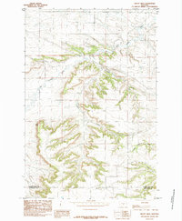
1985 · Mount Sinai
USGS Topo · 1:24,000
1985 · Locomotive Butte SE
USGS Topo · 1:24,000
1985 · Eagle Point
USGS Topo · 1:24,000