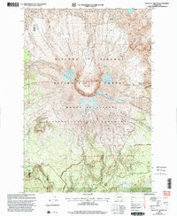
1998 Map of Mount St. Helens
USGS Topo · Published 2003About this map
Mount St Helens stands at the center of this landscape, its topography defined by the massive 1980 Crater and the emerging Lava Dome. This 1998 revision by the Forest Service illustrates a terrain in active transformation within the Mount St Helens National Volcanic Monument, where the northern face is dominated by The Breach and the expansive Pumice Plain. The survey details a complex system of ice and debris, including the Loowit Glacier, Forsyth Glacier, and Shoestring Glacier, alongside significant geological formations like the Floating Island Lava Flow. To the south, the environment transitions toward recreational and access points such as the Marble Mtn Sno-Park and Redrock Pass. The map serves as a precise record of the post-eruption recovery and the shifting boundaries between the Gifford Pinchot National Forest and the volcanic monument.
Find a feature on this map
33 named features on this map. Tap any name to fly to it.
Don’t see what you’re looking for? This feature index may not catch every label — zoom into the map to look around manually.
Map Details
Editions of this 1998 Mount St. Helens Map
This is the sole edition of this map. No revisions or reprints were ever made.
Other maps of this area

1919 · Mount St Helens
USGS Topo · 1:125,000

1953 · Hoquiam
USGS Topo · 1:250,000

1953 · Cougar
USGS Topo · 1:62,500

1953 · Elk Rock
USGS Topo · 1:62,500

1957 · Hoquiam
USGS Topo · 1:250,000

1957 · Spirit Lake
USGS Topo · 1:62,500

1958 · Mt St. Helens
USGS Topo · 1:62,500

1958 · Hoquiam
USGS Topo · 1:250,000

1962 · Hoquiam
USGS Topo · 1:250,000

1975 · Mt. St. Helens NE
USGS Topo · 1:24,000