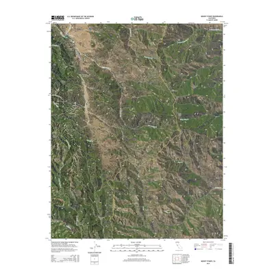
2015 Map of Mount Stakes
USGS Topo · Published 2015About this map
Ashrama sits amidst the drainage of Jumpoff Cr in this high-elevation region of the Diablo Range, where the boundary between Santa Clara and Stanislaus counties follows the crests of the land. The map showcases a landscape defined by sharp elevation changes and numerous seasonal waterways, including the upper reaches of San Antonio Cr and the East Fork Coyote Creek. Settlements are sparse and oriented toward the valley floors, notably at Isabel Valley and Upper San Antonio Valley.
Find a feature on this map
33 named features on this map. Tap any name to fly to it.
Don’t see what you’re looking for? This feature index may not catch every label — zoom into the map to look around manually.
Map Details
Editions of this 2015 Mount Stakes Map
This is the sole edition of this map. No revisions or reprints were ever made.
Other maps of this area

1897 · Mt. Hamilton
USGS Topo · 1:62,500

1917 · Morgan Hill
USGS Topo · 1:62,500

1921 · Gilroy Hot Springs
USGS Topo · 1:62,500

1938 · Mt. Boardman
USGS Topo · 1:62,500

1939 · Morgan Hill
USGS Topo · 1:62,500

1939 · Gilroy Hot Springs
USGS Topo · 1:62,500

1940 · Gilroy Hot Springs
USGS Topo · 1:62,500

1941 · Morgan Hill
USGS Topo · 1:62,500

1942 · Mt. Hamilton
USGS Topo · 1:62,500

1942 · Mt. Boardman
USGS Topo · 1:62,500