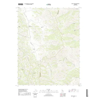
2018 Map of Mount Stakes
USGS Topo · Published 2018About this map
Ashrama serves as a focal point within the high country of the Diablo Range, situated along the winding route of Upper San Antonio Valley Rd. This 2018 survey documents the remote transition between Santa Clara and Stanislaus counties, a landscape defined by sharp elevation changes and deeply incised drainages like Ivy Canyon and Gooseberry Canyon. The map reveals a network of high ridges and isolated flats, including Isabel Valley and Grizzly Flats, which have long been associated with ranching and seasonal grazing in this part of the California Coast Ranges.
Find a feature on this map
42 named features on this map. Tap any name to fly to it.
Don’t see what you’re looking for? This feature index may not catch every label — zoom into the map to look around manually.
Map Details
Editions of this 2018 Mount Stakes Map
This is the sole edition of this map. No revisions or reprints were ever made.
Other maps of this area

1897 · Mt. Hamilton
USGS Topo · 1:62,500

1917 · Morgan Hill
USGS Topo · 1:62,500

1921 · Gilroy Hot Springs
USGS Topo · 1:62,500

1938 · Mt. Boardman
USGS Topo · 1:62,500

1939 · Morgan Hill
USGS Topo · 1:62,500

1939 · Gilroy Hot Springs
USGS Topo · 1:62,500

1940 · Gilroy Hot Springs
USGS Topo · 1:62,500

1941 · Morgan Hill
USGS Topo · 1:62,500

1942 · Mt. Hamilton
USGS Topo · 1:62,500

1942 · Mt. Boardman
USGS Topo · 1:62,500