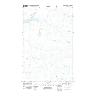
2011 Map of Mount Stickney
USGS Topo · Published 2011About this map
Mount Stickney and the surrounding peaks of the Cascade Range dominate this 2011 survey, which illustrates the complex drainage systems of the Sultan River and Wallace River watersheds. The landscape is defined by its glacial hydrology, featuring numerous high-elevation water bodies such as Big Greider Lake, Little Greider Lake, and Boulder Lake. In the northern portion of the map, Spada Lake serves as a major catchment, fed by Williamson Creek and McCarty Creek. A notable point of human activity in this otherwise wild terrain is the Kromona Mine, located near the headwaters of the Middle Fork South Fork Sultan River. The map also traces an intricate network of Forest Service roads, including 6012, providing access to remote landmarks like Prospect Peak and the steep slopes of Ragged Ridge. These features reflect the area's ongoing significance for both resource extraction and watershed management.
Find a feature on this map
34 named features on this map. Tap any name to fly to it.
Don’t see what you’re looking for? This feature index may not catch every label — zoom into the map to look around manually.
Map Details
Editions of this 2011 Mount Stickney Map
This is the sole edition of this map. No revisions or reprints were ever made.
Other maps of this area
1899 · Glacier Peak
USGS Topo · 1:125,000
1899 · Stillaguamish
USGS Topo · 1:125,000
1901 · Glacier Peak
USGS Topo · 1:125,000
1901 · Stilaguamish
USGS Topo · 1:125,000
1902 · Skykomish
USGS Topo · 1:125,000
1905 · Skykomish
USGS Topo · 1:125,000
1921 · Sultan
USGS Topo · 1:125,000
1923 · Sultan
USGS Topo · 1:125,000

1955 · Concrete
USGS Topo · 1:250,000
1957 · Silverton
USGS Topo · 1:62,500