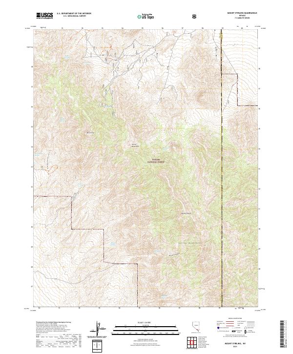
2021 Map of Mount Stirling
USGS Topo · Published 2021About this map
Mt Stirling dominates this section of the Spring Mountains within the Toiyabe National Forest, where the high-altitude terrain meets the northern reaches of the Mojave Desert. This arid landscape is defined by its critical water sources, scattered across the slopes as a series of isolated springs including Jaybird Spring, Gold Spring, and the clustered Bill Smith Springs. The presence of these named water points suggests their historical importance for travelers and livestock in a region where surface water is otherwise absent. Transport through the area is limited to rugged tracks like Thurber Rd and the Horseshoe Springs Loop Trl, which provides access to the western canyons. The map also captures the administrative boundary between Nye and Clark counties, cutting through the eastern portion of Wood Canyon.
Find a feature on this map
21 named features on this map. Tap any name to fly to it.
Don’t see what you’re looking for? This feature index may not catch every label — zoom into the map to look around manually.
Map Details
Editions of this 2021 Mount Stirling Map
This is the sole edition of this map. No revisions or reprints were ever made.
Other maps of this area

1907 · Las Vegas
USGS Topo · 1:250,000

1908 · Furnace Creek
USGS Topo · 1:250,000

1908 · Las Vegas
USGS Topo · 1:250,000

1910 · Furnace Creek
USGS Topo · 1:250,000

1942 · Indian Spring
USGS Topo · 1:125,000

1942 · Skull Mountain
USGS Topo · 1:125,000

1948 · Death Valley
USGS Topo · 1:250,000

1952 · Specter Range
USGS Topo · 1:62,500

1952 · Mercury
USGS Topo · 1:62,500

1954 · Las Vegas
USGS Topo · 1:250,000