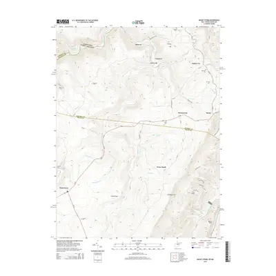
2014 Map of Mount Storm
USGS Topo · Published 2014About this map
North Branch Potomac River forms the state boundary here between Maryland and West Virginia, carving a deep valley that defines the local geography. Along the ridge lines and creek valleys, small settlements such as Emoryville, Sulphur City, and Hartmansville dot the landscape, connected by a network of winding county roads like Hartmansville Rd. The area is characterized by significant topographic relief, anchored by the Allegheny Front and high points like Mount Pisgah and Number 7 Hill. Family history is deeply rooted in this terrain, evidenced by numerous small burial grounds including Kalbaugh Cem, Kitzmiller Cem, and Evans Cem. Water features such as Abram Cr and Stony River flow through the valleys, while the Fore Knobs provide a dramatic backdrop to the south, illustrating the transition from river bottom to high mountain ridges.
Find a feature on this map
59 named features on this map. Tap any name to fly to it.
Don’t see what you’re looking for? This feature index may not catch every label — zoom into the map to look around manually.
Map Details
Editions of this 2014 Mount Storm Map
This is the sole edition of this map. No revisions or reprints were ever made.
Other maps of this area

1895 · Piedmont
USGS Topo · 1:125,000

1899 · Oakland
USGS Topo · 1:62,500

1900 · Oakland
USGS Topo · 1:62,500

1916 · Davis
USGS Topo · 1:48,000

1918 · Davis
USGS Topo · 1:62,500

1919 · Elk Garden
USGS Topo · 1:48,000

1919 · Davis
USGS Topo · 1:62,500

1920 · Elk Garden
USGS Topo · 1:48,000

1920 · Davis
USGS Topo · 1:48,000

1921 · Greenland Gap
USGS Topo · 1:62,500