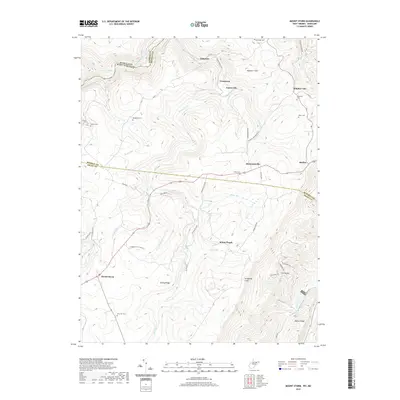
2019 Map of Mount Storm
USGS Topo · Published 2019About this map
The North Branch Potomac River forms the northern boundary of this West Virginia landscape, winding through a terrain defined by the Allegheny Front. Industrial history is etched into the land at the Kitzmiller Mine and along the various rural routes like Strip Job Rd, while early settlement is documented through a dense network of family cemeteries. Genealogists will find the Kalbaugh Cem, Kitzmiller Cem, and Dixon Cem near Sulphur City, along with the Evans Cem in Hartmansville. The map also captures several distinct ridges and peaks, including Mount Pisgah, Number 7 Hill, and the Fore Knobs, which separate the drainage of Abram Creek and the Stony River. Small communities such as Oakmont, Crosstown, and Skyline are linked by local connectors like Sulphur-Hartmansville Rd.
Find a feature on this map
59 named features on this map. Tap any name to fly to it.
Don’t see what you’re looking for? This feature index may not catch every label — zoom into the map to look around manually.
Map Details
Editions of this 2019 Mount Storm Map
This is the sole edition of this map. No revisions or reprints were ever made.
Other maps of this area

1895 · Piedmont
USGS Topo · 1:125,000

1899 · Oakland
USGS Topo · 1:62,500

1900 · Oakland
USGS Topo · 1:62,500

1916 · Davis
USGS Topo · 1:48,000

1918 · Davis
USGS Topo · 1:62,500

1919 · Elk Garden
USGS Topo · 1:48,000

1919 · Davis
USGS Topo · 1:62,500

1920 · Elk Garden
USGS Topo · 1:48,000

1920 · Davis
USGS Topo · 1:48,000

1921 · Greenland Gap
USGS Topo · 1:62,500